
Flood insurance costs and FEMA flood data: Queens
What homeowners in Queens pay for NFIP flood insurance, how that cost has moved, what share of residential buildings carry it, and how FEMA rates expected flood losses here. Every figure is calculated from FEMA public data.
Policies in force on August 31, 2026 · FEMA policy data as of September 8, 2026 · FEMA National Risk Index, December 2025 release
Flood insurance in Queens at a glance
How the cost has moved
Median yearly cost of single-family NFIP policies taking effect each month, last 24 months.
In Queens, the typical monthly median yearly cost of single-family NFIP policies taking effect in June through August 2026 was $1,400, 17% higher than the typical month in June through August 2025 ($1,200). Based on 2,038 and 2,106 policies.
Cost by FEMA flood zone
FEMA's A and V zones are its high-risk Special Flood Hazard Areas. V zones also face storm waves. X, B and C zones are moderate- to low-risk.
| Zone group | Policies | Median yearly cost | Middle half |
|---|---|---|---|
| High-risk A zones | 3,983 | $1,610 | $1,140–$2,400 |
| Coastal high-risk V zones | 24 | $1,780 | $1,240–$2,820 |
| Moderate- to low-risk zones (X, B, C) | 3,902 | $1,200 | $880–$1,400 |
Cost by ZIP code: all 59 ZIP codes
Single-family NFIP policies in force on August 31, 2026, for every ZIP code assigned to Queens, in ZIP order. FEMA's policy file carries no county, so each whole ZIP is assigned to the county where most of its FEMA claims are recorded. A ZIP code can cross town and county lines, so each row describes the ZIP, not a town.
Show all 59 ZIP codes
| ZIP | Policies | Median yearly cost | Middle half |
|---|---|---|---|
| 11004 | 6 small sample | $480 | $460–$570 |
| 11101 | 5 small sample | $1,380 | $1,340–$1,380 |
| 11102 | 2 small sample | $760 | $640–$880 |
| 11103 | 5 small sample | $710 | $560–$940 |
| 11104 | 6 small sample | $540 | $480–$630 |
| 11105 | 20 | $710 | $480–$760 |
| 11106 | 6 small sample | $1,410 | $1,000–$2,110 |
| 11354 | 17 small sample | $790 | $660–$1,150 |
| 11355 | 15 small sample | $1,200 | $840–$1,300 |
| 11356 | 32 | $1,330 | $960–$1,480 |
| 11357 | 109 | $1,080 | $770–$1,360 |
| 11358 | 40 | $860 | $660–$1,080 |
| 11360 | 17 small sample | $600 | $490–$770 |
| 11361 | 38 | $560 | $490–$690 |
| 11362 | 19 small sample | $690 | $650–$780 |
| 11363 | 117 | $1,040 | $800–$1,260 |
| 11364 | 29 | $710 | $540–$940 |
| 11365 | 40 | $960 | $720–$1,090 |
| 11366 | 25 | $700 | $570–$910 |
| 11367 | 13 small sample | $970 | $680–$1,130 |
| 11369 | 12 small sample | $900 | $810–$1,140 |
| 11370 | 9 small sample | $1,200 | $870–$1,240 |
| 11372 | 4 small sample | $1,010 | $740–$1,200 |
| 11373 | 3 small sample | $710 | $680–$940 |
| 11374 | 11 small sample | $990 | $930–$1,140 |
| 11375 | 81 | $780 | $650–$920 |
| 11377 | 13 small sample | $800 | $590–$940 |
| 11378 | 11 small sample | $700 | $600–$840 |
| 11379 | 25 | $970 | $610–$1,200 |
| 11385 | 27 | $700 | $600–$780 |
| 11410 | 1 small sample | $5,100 | $5,100–$5,100 |
| 11411 | 20 | $1,010 | $640–$1,200 |
| 11412 | 14 small sample | $550 | $460–$690 |
| 11413 | 39 | $920 | $760–$1,140 |
| 11414 | 1,516 | $1,200 | $940–$1,400 |
| 11415 | 4 small sample | $600 | $490–$680 |
| 11416 | 1 small sample | $470 | $470–$470 |
| 11417 | 12 small sample | $410 | $380–$440 |
| 11418 | 8 small sample | $440 | $390–$470 |
| 11419 | 4 small sample | $470 | $450–$500 |
| 11420 | 15 small sample | $450 | $440–$480 |
| 11421 | 7 small sample | $390 | $370–$390 |
| 11422 | 127 | $1,260 | $1,010–$1,580 |
| 11423 | 25 | $540 | $480–$690 |
| 11426 | 10 small sample | $530 | $480–$560 |
| 11427 | 14 small sample | $600 | $550–$720 |
| 11428 | 3 small sample | $550 | $470–$550 |
| 11429 | 7 small sample | $490 | $460–$550 |
| 11432 | 22 | $550 | $480–$770 |
| 11433 | 10 small sample | $660 | $540–$790 |
| 11434 | 28 | $690 | $600–$800 |
| 11435 | 5 small sample | $510 | $500–$610 |
| 11436 | 9 small sample | $620 | $560–$980 |
| 11468 | 1 small sample | $800 | $800–$800 |
| 11691 | 910 | $1,290 | $960–$1,860 |
| 11692 | 331 | $1,900 | $1,280–$2,480 |
| 11693 | 682 | $1,570 | $1,130–$3,020 |
| 11694 | 1,592 | $1,400 | $1,200–$1,540 |
| 11697 | 1,735 | $1,430 | $1,200–$2,060 |
FEMA flood-loss ratings by census tract
FEMA's National Risk Index rates each census tract's expected yearly losses from flooding against every census tract in the country. Here is how FEMA rates the 724 census tracts in Queens.
Coastal flooding
- Very High 4
- Relatively High 14
- Relatively Moderate 36
- Relatively Low 30
- Very Low 39
- No expected annual losses 601
Inland flooding (heavy rain, streams)
- Relatively High 8
- Relatively Moderate 44
- Relatively Low 238
- Very Low 433
- No expected annual losses 1
Flood information by town
Each community page has the same flood block: FEMA's ratings for its census tracts and flood-insurance costs for its ZIP code.
- Astoria
- Auburndale
- Bay Terrace
- Bayside
- Bellerose
- Ditmars-Steinway
- Douglaston
- East Elmhurst
- Forest Hills
- Fresh Meadows
- Glen Oaks
- Glendale
- Hollis Hills
- Jackson Heights
- Jamaica Estates
- Kew Gardens
- Kew Gardens Hills
- Little Neck
- Long Island City
- Maspeth
- Middle Village
- Oakland Gardens
- Queens Village
- Rego Park
- Ridgewood
- Sunnyside
- Whitestone
- Woodhaven
- Woodside
Flooding in the news: Queens
- CM Ariola calls for ‘major infrastructure overhaul’ to combat flooding after weekend storm wreaks havoc in south Queens – QNS
- Nor’easter topples trees, floods streets
- Floods hit Hamilton, Howard Beach again
- Queens’ coastal communities flooded again as officials call for action — Queens Daily Eagle
- Nor'easter leaves flooding, downed trees across New York City
- Nor'easter lashes NYC, Long Island with heavy rain, wind and flooding
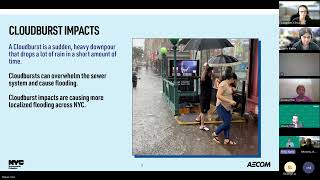 Kissena Cloudburst Hub Community Meeting #1 Presentation
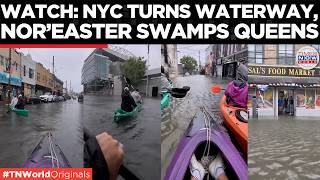 NYC FLOOD CHAOS: New Yorkers Kayak Through Queens Streets Amid Powerful Nor’easter | Times Now World
 Nor'easter slams NYC area: Severe coastal flooding, high winds continue
 Heavily Flooded Howard Beach Queens Streets during Nor'easter Sunday Coastal Flood
Check a specific address
Frequently asked questions
How much does flood insurance cost in Queens?
For single-family homes with NFIP policies in force on August 31, 2026, the median yearly cost in Queens was $1,320, with the middle half of policies between $1,020 and $1,740 (7,909 policies). In FEMA's high-risk A zones the median was $1,610 (3,983 policies). Each building is priced individually, so a quote for a specific home can differ.
What share of residential buildings in Queens have NFIP flood insurance?
FEMA counted 11,977 residential NFIP contracts in force against 322,316 residential buildings in Queens as of August 3, 2026, a share of 3.7%. One contract can cover a whole multi-unit building, and private flood policies are not included.
Has flood insurance gotten more expensive in Queens?
In Queens, the typical monthly median yearly cost of single-family NFIP policies taking effect in June through August 2026 was $1,400, 17% higher than the typical month in June through August 2025 ($1,200). Based on 2,038 and 2,106 policies.
Does a standard homeowners policy cover flood damage?
No. Standard homeowners policies exclude flood damage. Flood coverage is bought separately, through the National Flood Insurance Program (NFIP) or from a private flood insurer.
When is flood insurance required?
When a mortgage comes from a federally regulated or insured lender and the building sits in one of FEMA's high-risk flood zones (a Special Flood Hazard Area, zones beginning with A or V), the lender requires flood insurance. Outside those zones it is optional, and lenders may still require it.
How is NFIP flood insurance priced?
Since 2021 FEMA prices each building individually under Risk Rating 2.0, using factors such as distance to water, the type and frequency of flooding, the foundation type, the height of the lowest floor, prior claims and the cost to rebuild. Two homes on the same street can pay different amounts.
How do I find the flood zone for a specific address?
Search the address on FEMA's Flood Map Service Center (msc.fema.gov). In Queens and Brooklyn, NYC's Flood Hazard Mapper and FloodHelpNY also show current and future flood zones.
How these figures are measured
- Yearly cost
- FEMA's "policy cost": the premium plus FEMA fees and surcharges, which is what the policyholder pays. Median and middle half (25th to 75th percentile), rounded to the nearest $10.
- Which policies
- NFIP policies on single-family homes (FEMA occupancy type 11) in force on August 31, 2026, from FEMA's OpenFEMA policy file as of September 8, 2026. Condo buildings, multi-unit buildings and commercial policies are left out so they cannot move a home figure. Private flood insurance is not in FEMA's data.
- Trend
- Monthly medians of policies by the month they took effect. The direction compares the latest months with the same calendar months a year earlier, using the same engine as the site's market trends, and states both periods.
- Residential buildings with NFIP insurance
- FEMA's NFIP residential penetration rate: residential NFIP contracts in force divided by all of the county's residential structures (every residential building type, not only single-family), on FEMA's own as-of date.
- County of a ZIP code
- FEMA's policy file carries ZIP codes but no county, so each whole ZIP is assigned to the county where most of its FEMA claims are recorded (else by its USPS prefix). A ZIP that crosses a county line is counted in one county.
- Claims (hub only)
- FEMA's NFIP claims file, all building types and years, grouped by the event name FEMA records.
- FEMA flood-loss ratings
- FEMA National Risk Index (December 2025 release), Expected Annual Loss rating for coastal and inland flooding, by census tract. FEMA also publishes a composite "Risk Index" that scales expected losses by community social-vulnerability and resilience scores, which are built from demographic data. These pages show only the expected-loss ratings, which rest on physical exposure and loss history.
- Small samples
- Figures based on fewer than 20 policies are shown and marked "small sample".
Sources: FEMA National Flood Insurance Program policy data (OpenFEMA, as of September 8, 2026); FEMA NFIP residential penetration rates; FEMA National Risk Index (December 2025 release). Medians, ranges and trends are calculated from those records; FEMA's ratings and labels are quoted as FEMA publishes them. "Yearly cost" is what the policyholder pays: premium plus FEMA fees and surcharges, for single-family homes only. The insured share is FEMA's residential NFIP contracts in force as a share of all residential buildings. NFIP policies only; private flood insurance is not included. This is not a flood-zone determination, insurance advice or a quote; under FEMA's Risk Rating 2.0 each building is priced individually. Check a specific address with FEMA's Flood Map Service Center and get a quote from a licensed insurance professional.
The DeVito Team compiled these figures from FEMA public data. Joseph DeVito, NY Licensed Associate Real Estate Broker. This is general information, not legal, insurance or flood-risk advice.